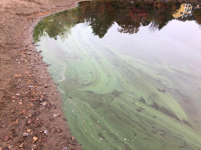
Blue green algae bloom in Cunard Pond
on Oct 25, 2022 Photo by Melanie Dobson.
It was “also visible in the inlet on
the east side of Grandstand.
Commented M.D.: Potential Blue-green algae
bloom spotted in Cunard Pond and in an
inlet of Williams Lake along the
Wyndrock Drive causeway. Children and pets
should be kept away from the Cunard Beach
area and the water’s edge along Wyndrock,
including the Grandstand Island.”
Williams Lake Waterflow Report, 2020
by Melanie Dobson, on WLCC website
Bacterial Levels
By Melanie Dobson on WLCC website. “The Williams Lake Conservation Company monitors important environmental indicators. For Williams Lake coliform counts 2010-2020 click here: Williams Lake Bacterial Tests 2010-2020
For Williams Lake coliform counts 2001-2014 click here: Lake Water Testing Results 2001-14
Reports on Water Quality/Water Levels by Melanie Dobson in WLCC Newsletters
2023, 2021, 2019, 2018 and earlier dates
Healthy Lakes and Wetlands for Tomorrow: A LANDOWNER STEWARDSHIP GUIDE FOR SPECIES AT RISK IN NOVA SCOTIA
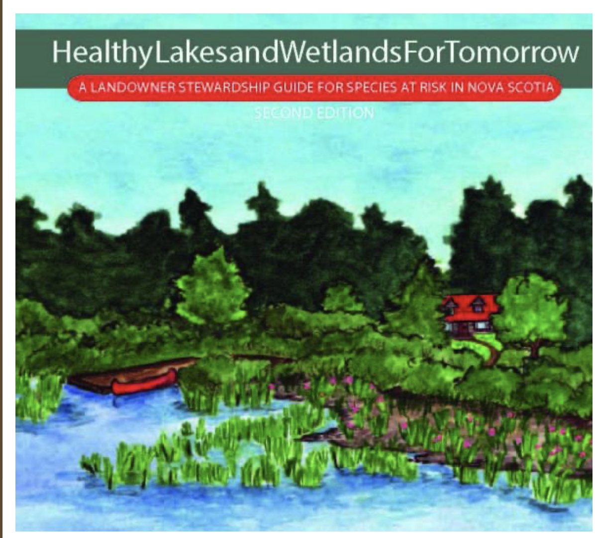 Mersey Tobeatic Research Institute “Welcome to the Landowner Stewardship Guide. This site is an online companion to the booklet “Healthy Lakes and Wetlands For Tomorrow: A Landowner Stewardship Guide to Species at Risk in Nova Scotia”. Contact the Mersey Tobeatic Research Institute to obtain a printed guide. This guide is for everyone interested in conserving and protecting the freshwater and wetland habitats in Nova Scotia. Although there is a focus on the species at risk that depend on these habitats, these practices are good to follow no matter where you live and who you share your land with. Species at risk can act as umbrella species for habitats and ecosystems. By following the actions in this guide you will not only help to protect the species that are in danger of being lost from our province but all the creatures in Nova Scotia, including ourselves!
Thx to Martha Leary for forwarding info about this resource
Vernal Pool Mapping in the Williams Lake Watershed, Halifax
Project Report by Huan Liu, Dalhousie School of Planning, 2012. This project tested several remote sensing approaches for documenting vernal pools by employing them individually in mapping potential vernal pools in the undeveloped area of the central Williams Lake Watershed. Field observations examined the accuracy of the predictions and an evaluation of the methods and data that this project used.
 Water Channels to Wetlands in the Williams Lake Backlands
by Nick Hill and David Patriquin, 2014. 36 pages, 6 MB file. Pages extracted from Ecological Assessment of the Plant Communities of the Williams Lake Backlands. Includes a key to wetland types, descriptions of water flow, relevance to conservation.
WESP Report on Wetlands by mouth of Colpitt to Williams Lake watercourse
Assessment conducted on Aug 31, 2020 by Emma Bocking of Ducks Unlimited
Mapping wetlands in Nova Scotia with multi-beam radarsat-2 polarimetric sar, optical satellite imagery, and elevation data
Jahncke, Raymond. MES Thesis, Dalhousie University 2016 “Nova Scotia introduced a new wetland policy in 2011 which included a goal to have no net loss of wetlands. In order to meet this goal, the Nova Scotia government has committed to updating the provincial wetland inventory. The objective of this study will be to assess the accuracy of wetland mapping using remote sensing processes based on RADARSAT-2 polarimetric SAR images, optical imagery, and elevation data. RADARSAT-2 polarimetric SAR images were acquired between 2010 and 2013 over an area southwest of Halifax. …The study area is located southwest of Halifax, Nova Scotia, and covers much of Long Lake Provincial Park and the Herring Cove Backlands.”
Pristine Shoreline of Colpitt Lake (Video)
David P paddles the shoreline on June 20, 2015 and comments on what he sees.
Water quality measurements on Williams Lake and Colpitt Lake (Halifax, N.S.) Dec 7-13, 2015 with reference to possible impacts of road salt
Report to Williams Lake Conservation Company (WLCC) by David Patriquin, Jan 6, 2016. There is evidence for delayed (or possibly absence) of the fall turnover of the water column in Williams lake which may be related to salt induced stratification. Conditions have clearly deteriorated since 1990/1991. Even though three-quarters of the watershed is undeveloped, salt inputs from the other 1/4 are having significant impacts on the health of both Colpitt Lake and Williams Lake.
Williams Lake, Halifax. Nova Scotia: An Investigation of the Aquatic Ecosystem of an Urbanizing Watershed [1991/1992].
Report by R. Scott to Nova Scotia Department of the Environment, 1992. 39 pp. The document includes detailed bathymetry; vertical profiles of temperature, electrical conductivity (salinity) and pH observed in 1990/91; nitrogen, phosphorous and chlorophyll; and contrasts these observations with those of earlier studies during a period of higher salt and nutrient loading.
Technical evaluation of the Halifax Harbour Cleanup Inc.: Environmental assessment report for the Halifax-Dartmouth Metropolitan sewage treatment facility.
Document prepared on behalf of the William’s Lake Conservation Company (WLCC) by Patricia Manuel, and Martin Willison, Oct 2, 1992. The authors address possible impacts of a proposed connector tunnel for sewage that would be bored through bedrock across the Wildlands. (The project did not go ahead.)
Land-Use Change and Aquatic Macroinvertebrate Community Structure in the McIntosh Run,
Nova Scotia Canada
Michelle Simone. Honours Thesis, 2012 Environmental Science, Dalhousie University “Land-cover refers to the physical and biological cover of a land’s surface; including water, vegetation, soil, and/or artificial structures (Ellis 2011). This differs from land-use, which is a more complicated term that natural scientists refer to as syndromes of human activities…”
Existing water quality and characteristics of Spryfield area lakes and MacIntosh Run
JG Ogden, 1972, 42 pages. Includes analyses of plankton by J.N. Cooley.
Williams Lake Fish & Water Quality
Draft Report by Jack Creeper, 1972. results of gill-netting, water quality measurements in 1971
Williams Lake trout Stocking
by Allan Mackinnon, no date “Records show that the first recorded stocking of trout (rainbow) took place in 1901, by the Mic Mac Fishing Club of Halifax. Nothing else is mentioned until th~ mid 1950′ when the Dept. of Lands and Forest began a program of re-stocking but the numbers and dates were kept by the individual hatcheries involved, most of which are now defunct. The Dept. of
Fisheries began centralized data keeping in 1976 which show that Williams Lake was stocked for ten of the years between 76-88 with 74,405 speckled trout.