

Click on images for larger versions
Watersheds, Watercourses and Wetlands of the Halifax Backlands
– YouTube Video of David Patriquin’s Webinar presentation on Aug 15, 2023 with Q&As.
– Slides for the presentation (29 slides, 18 MB)
(A link to the full webinar will be posted when it becomes available.)
| SUMMARY As documented by N. Hill, the water regime in the Halifax Backlands has features of dryland systems, with intermittent stream courses probably accounting for a majority of the water flow.
Highlighted in this presentation are Mountain Holly Washes, Boulder Fields, Vernal Pools, and Whaleback Troughs. They are critical components of watercourses but some (Mountain Holly Washes, Boulder Fields – documented by N. Hill – & Whaleback Troughs – documented by D. Patriquin) are not well protected by Nova Scotia’s watercourse or wetland regulations because any surface water is seasonal and/or they are too small (<100m2) or they do not qualify as wetlands; or as wetlands (Vernal Pools – documentation by N. Hill & P. Manual & students) they are simply overlooked even if>100m2 area because wetland protection tends to be focussed on defining the boundaries of an individual wetland, rather than on its role as a component of a watercourse. Larger wetlands (swamps & fens) interrupted the spread of the massive 2009 Spryfield fire; smaller wetlands burned over but recovered within 2-3 years. During recent torrential mid-summer rains, a lot of water was stored in fens and swamps and there was no noticeable disruption/erosion of the downstream watercourses lying within mostly forested landscapes. Significant stands of invasive Multiflora Rose, Japanese Knotweed and Privets were observed along Lawsons Brook at the perimeter of the Backlands in July 2023 and may be displacing Canada Holly; on the banks/more elevated areas Japanese Knotweed is a significant invasive. However, there were no exotic or invasive species along a major watercourse/single-track trail in the Shaw Wilderness Park. Significant salinization is occurring in watercourses with headwaters in developed areas. In the discussion, it was contended that we really can’t develop within the Backlands and maintain their ecological qualities because of the relatively small area remaining (circa 1350 ha) and because we simply can’t substitute for the roles of the smaller but cumulatively significant small wetlands and watercourses. |
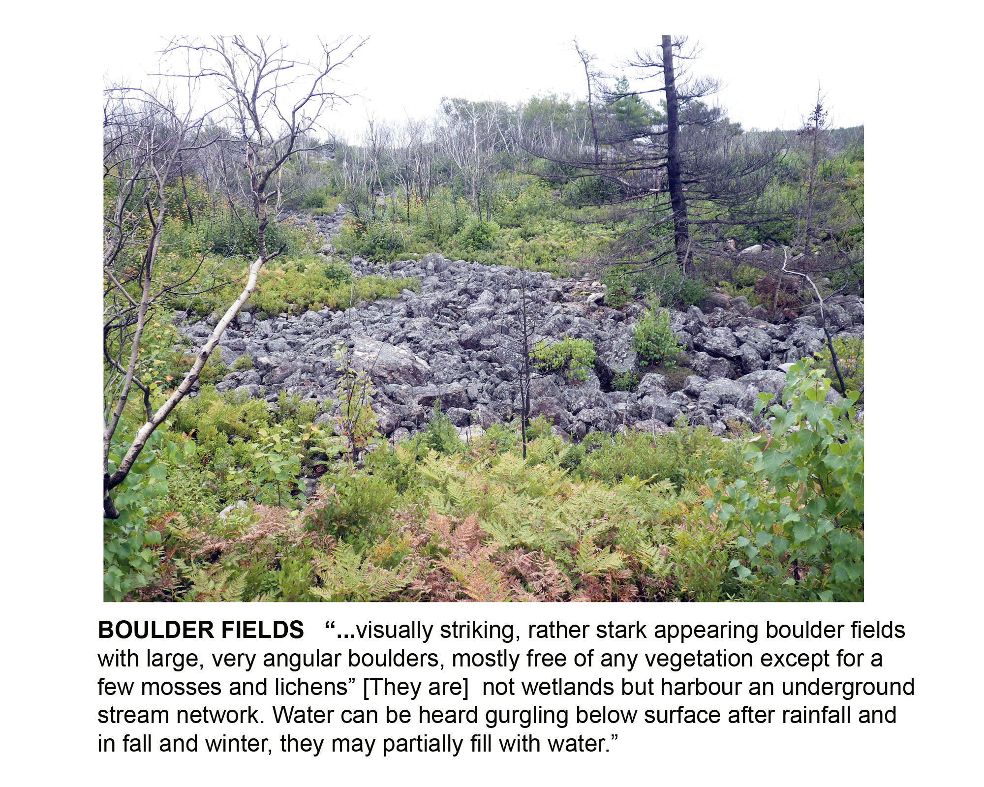 Boulder Fields |
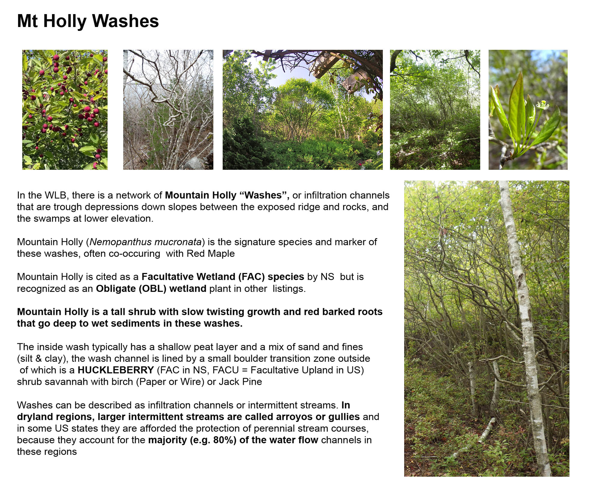 Mt Holly Washes |
 Vernal Pools |
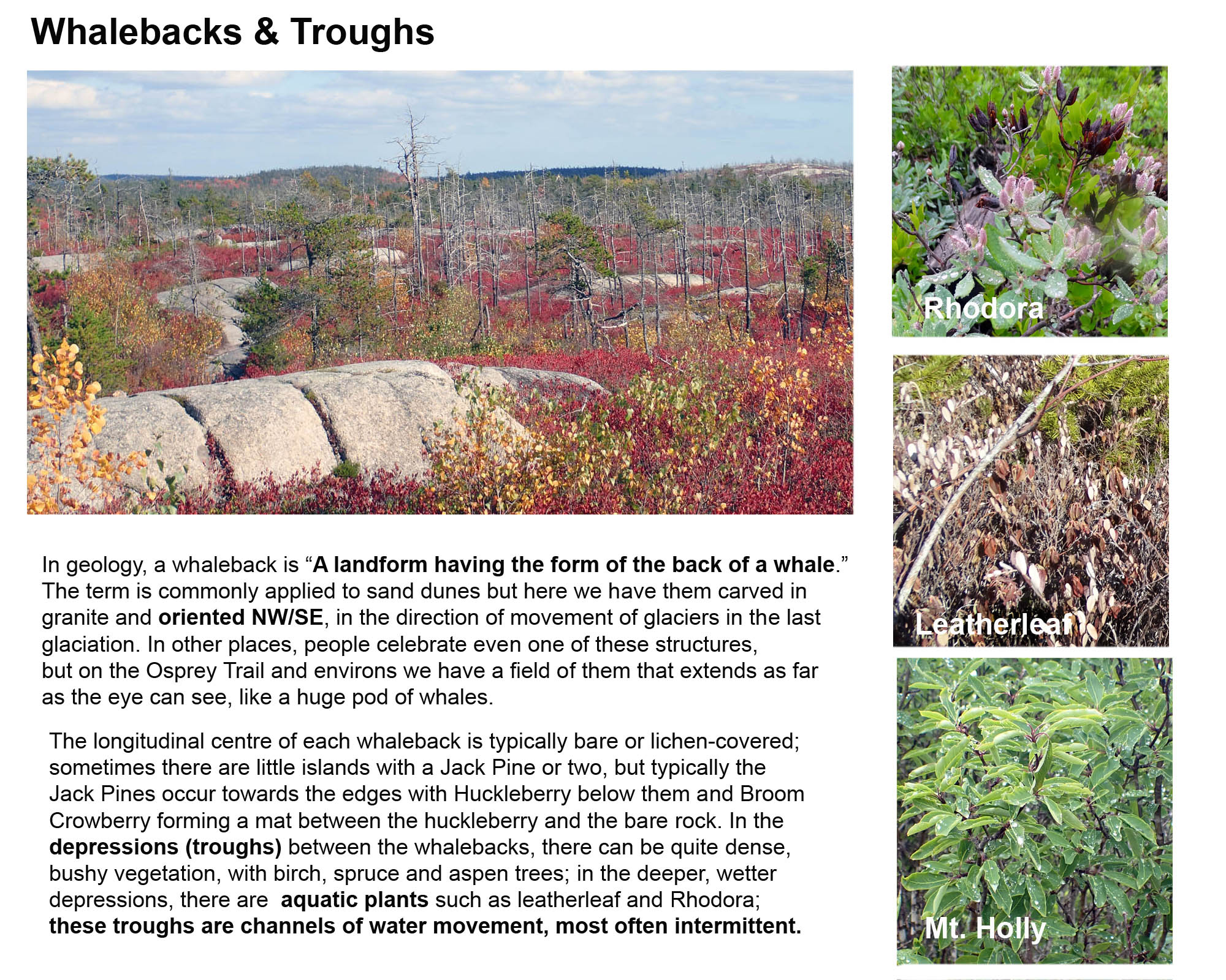 Whalebacks & Troughs |
Sources of Info for Patriquin’s Webinar presentation
Ecological Assessment of the Plant Communities of the Williams Lake Backlands
N. Hill and D. Patriquin, Report to The Williams Lake Conservation Company (Feb 13, 2014).
Water Channels to Wetlands in the Williams Lake Backlands
by Nick Hill and David Patriquin, 2014. 36 pages, 6 MB file. Pages extracted from Ecological Assessment of the Plant Communities of the Williams Lake Backlands. Includes a key to wetland types, descriptions of water flow, relevance to conservation.
Vernal Pool Mapping in the Williams Lake Watershed, Halifax
Project Report by Huan Liu, Dalhousie School of Planning, 2012. This project tested several remote sensing approaches for documenting vernal pools by employing them individually in mapping potential vernal pools in the undeveloped area of the central Williams Lake Watershed. Field observations examined the accuracy of the predictions and an evaluation of the methods and data that this project used.
Pristine Shoreline of Colpitt Lake (Video)
David P paddles the shoreline on June 20, 2015 and comments on what he sees.
Water quality measurements on Williams Lake and Colpitt Lake (Halifax, N.S.) Dec 7-13, 2015 with reference to possible impacts of road salt
Report to Williams Lake Conservation Company (WLCC) by David Patriquin, Jan 6, 2016. There is evidence for delayed (or possibly absence) of the fall turnover of the water column in Williams lake which may be related to salt induced stratification. Conditions have clearly deteriorated since 1990/1991. Even though three-quarters of the watershed is undeveloped, salt inputs from the other 1/4 are having significant impacts on the health of both Colpitt Lake and Williams Lake.
CB Observations Gov. Bk/Colpitt Lake
Charles Bull has been conducting “Citizen Science” observations on Electrical Conductivity (a measure of salt content) & Temperature of surface waters at 3 locations in the upper Williams Lake Watershed. (Page on this website.)
Osprey Trail: pine barrens & whalebacks
(Page on this website.)
Exotic & Invasive plant species on Lawsons Brook
A mid-summer 2023 Survey (Page on this website.)
Regeneration of Forest and Barrens after the Spryfield Fire of April 30, 2009
Photo-essay by Richard Beazley and David Patriquin. On April 30/May 1, 2009, an intense forest fire “cut a swath though Spryfield, Purcell’s Cove and Ferguson’s Cove.” (Chronicle Herald May 2, 2009). This set of photos illustrates the regeneration of vegetation over the ensuing 16 months.
View WETLANDS: SOME SOURCES & RESOURCES for links to some pertinent HRM & provincial docs.