
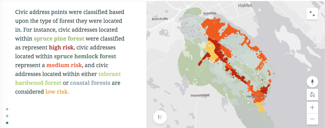
 Sasha Mosky, a Master of Planning student at Dalhousie University, examined fire risk in the Eastern Chebucto Peninsula Backlands. Using civic address point data, Sasha created a 4-kilometer buffer around all homes in the backlands. Then, using Ecological Land Classification data, Sasha classified the various ecosystem types found within the backlands according to their relative fire risk. The findings, which showcase the fire risk for homes across the backlands, are displayed in an ESRI Story Map.
This project was completed by Sasha Mosky for Dalhousie University’s Forest Ecology course (taught by Dr. Alana Westwood).
View the Project Story Map