 UPDATE May 11, 2021 9 pm: THE MOTION WAS PASSED
View video of meeting
Staff presentation begins at 1:38 (hr, min) Kathleen Hall, Karen Mckendry and Martha Leary made presentations at the end; go to 2:05 (hrs minutes)
Tonight Halifax and West Community Council will consider the recent HRM staff report on the Church of Christ Lands via a virtual meeting. Here is the link to the report ….. and the link to the meeting.
Some Background from the Report
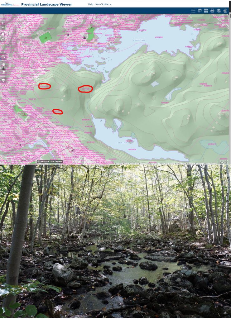
In late 2019, three privately-owned parcels of land (PIDs 00271585, 00323139, 00323147) located on the south side of Williams Lake were listed for sale (subject lands). Due to the location of the subject lands on Williams Lake, adjacent to the Shaw Wilderness Park on the edge of the Purcell’s Cove Backlands, community members expressed concern that the subject lands could be developed without consideration for their environmental value and result in negative impacts to the ecological integrity of the broader area.
To respond to these concerns, on June 17, 2020, Halifax and West Community Council (HWCC) requested a staff report that would consider rezoning the subject lands to Urban Reserve. HWCC intended that this change would limit inappropriate development of the lands. This report provides information on the current land use policy and regulations applied to the subject lands, the changes that have occurred in the area since those policies were adopted and recommends that Regional Council initiate the Plan amendment process to better protect environmentally-sensitive features both on the subject lands and the broader Purcell’s Cove Backlands area.
…The subject lands are within the Williams Lake watershed and include areas with significant tree cover, some exposed bedrock, significant slopes adjacent to Williams Lake, and several watercourses. The Governor’s Brook watercourse runs from west to east along the south end of the subject lands (PID 00323147), feeding into Colpitt Lake. An additional watercourse runs across the subject lands (PID 00271585) from Colpitt Lake northward to Williams Lake. These watercourses and their riparian areas, as well as other smaller streams and wetlands throughout the subject lands, are important for ecological integrity of the area, including the water quality of Williams and Colpitt Lakes, wildlife habitat and species diversity.

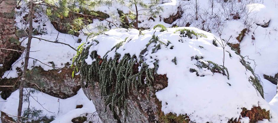
PID 00271585 includes the critical watercourse from Colpitt Lake to Williams Lake shown in photo; PID 00323147 encompasses a significant portion of Governor’s Brook. Click on images for larger versions
The report suggests that Community Council approve the following two recommendations:
“That Halifax and West Community Council recommend that Regional Council direct the Chief Administrative Officer to:
1.Initiate a process to consider site-specific amendments to the Halifax Secondary Municipal Planning Strategy and Halifax Mainland Land Use By-law for PID 00323139, and portions of PIDs 00271585 and 00323147 zoned Residential Development District (RDD), in order to better protect the environmentally-sensitive features identified on Maps 3a and 3b of the Mainland South SPS; and follow the public participation program for municipal planning strategy amendments as approved by Regional Council on February 27, 1997; and
2.Consider amendments to the Regional Municipal Planning Strategy, the Halifax Secondary Municipal Planning Strategy and Halifax Mainland Land Use By-law for lands currently designated and zoned Urban Reserve in the Purcell’s Cove Backlands area (as shown on Map 1 of this report), through the ongoing Regional Plan Review (Case 22257) in order to protect environmentally-significant features in the area, consistent with the policy directions outlined in this report.”
Comments Kathleen Hall, Co chair, Backlands Coalition:
We believe that the recommendations do move the issues with the Church of Christ lands and the Backlands forward although they are not exactly what we would have desired. However, with the Regional Plan review currently underway the timing for the work to be done is now and we want to take advantage of this opportunity.
———-
Related: WESP Report on Wetlands by mouth of Colpitt to Williams Lake watercourse
Assessment conducted on Aug 31, 2020 by Emma Bocking of Ducks Unlimited

